Saturday, May 15th 2010
Yellowjacket Creek 1660 cfs.
Class IV-V
8 miles?
After many weeks of waiting, Yellowjacket creek came into an ideal level to run for the first time, only one issue; all of the regulars "had other plans". So Friday night I was making the frantic phone calls to everyone in the phone chain, and before I got a chance to call Jared, he called me. What a relief! Jared and his friend Jerry, who is from Seattle were going to meet me in Morton and were excited to run a cool section of whitewater.
We were going to run a uncommonly run section of Yellowjacket creek by putting on upstream of the typical put-in. The upper section includes more class III and IV rapids, and a class V waterfall, adding an additional 3+ miles to an already quality section of whitewater.
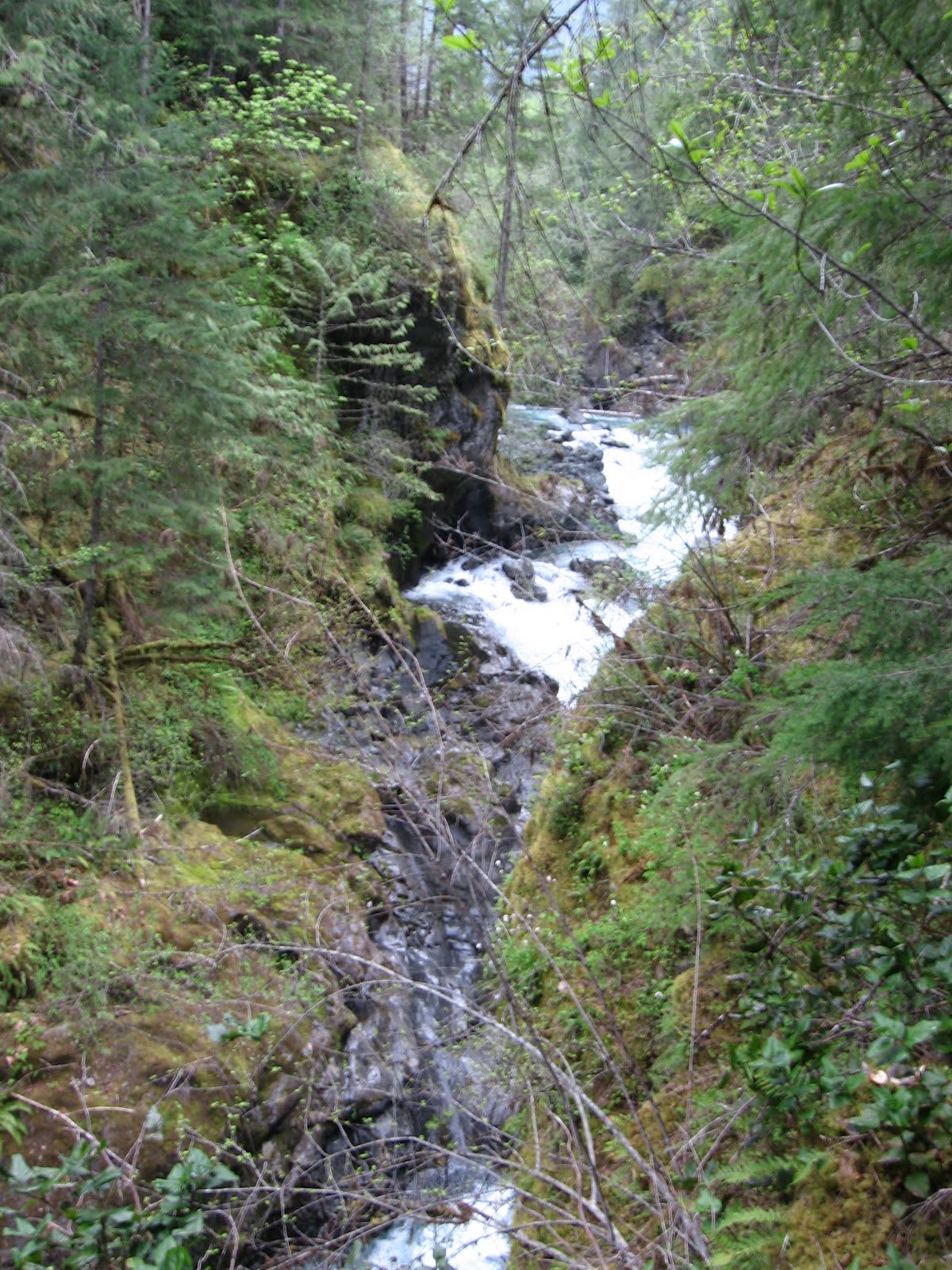
We park our car at the bridge that crosses Yellowjacket on FR 28 rd and loaded up to head to the goods. Once ready we drove 7+ miles before we reached an obvious triple fork in the road and decided that we had likely found the alternate put-in. We were able to park just seconds from the river, which is much better than the traditional put-in which utilizes a class V hike down a steep hill over loose gravel that takes the better part of an hour, but all we had to do was jaunt down to the river.
The put-in had a monster old growth tree laying in the river and the remnants of a bridge that had washed out years ago. I took a long time stretching because I had spent the better part of Friday weed-wacking and was more sore than I cared to be. And thankfully I did. The description I had read stated that there was only class III rapids above the waterfall, but the rapid directly below the put-in was definitely a class IV. The put-in rapid was a boulder garden with a line that zig-zagged down the middle.
Below the put-in drop was read-and-run class III shoals and ledges, and woody rapids. From the put-in to the traditional put-in there was a fair amount of annoying wood. None of it was very dangerous, and much of it we could paddle through or around, but there was also a bit that needed to be portaged at river level. All easy portages, but were obscuring the exit of several class III drops with no eddy mid rapid to catch so we would be forced to portage the whole drop.
After a bit of this we came to our next big rapid, which had some wood in it. But this rapid was also above a significant horizon line, with a narrow line in it. If this rapid didn't have wood in it it would still be a serious rapid because it was in very close proximity to an unrunnable drop. We portaged around the entrance drop and the log-choked-falls. The falls required downclimbing to a small eddy, and lowering the boats down the cliff. The rapid below was cool because there was wood spiderwebbing overhead that we paddled under before making a move to the right to boof a ledge at the bottom, really fun.

Entrance rapid to unrunnable Log Choked falls

Spider webbing logs in run-out

Pondering the improbable Photo by Jerry Palushock
After this we encountered a class IV+ maybe V rapid that had a ugly looking entrance drop that had a slide into confused water that eventually pushed you far left against the wall before you had to paddle hard to the right through a boulder garden to the bottom of the drop. When I looked at the drop it made me uneasy, but when I saw Jared run clean I figured it must be good to go. I ran second followed by Jerry, all of us had clean lines.
After a few more wood dodges we came to the waterfall that we all came down here for, which for now I will call Upper Yellowjacket falls. Initially Jared scouted from the left because that was the side we eddied out on and it ended up being a nuisance. Jared tried giving me verbal beta, but it wasn't matching up with a picture of the falls I had seen, so I walked back to my boat and paddled across the river to scout from the river right side. This ended up working out for the best for us because I was able to take some shots of Jerry and Jared running the falls, and then Jerry was able to take some shots of me from below. Which I was excited about because I rarely have any pictures of me. Jared ran first and had a clean line and so did Jerry.

Jared in entrance rapid to falls
This drop wasn't even the hardest rapid we had ran yet today, but it was definitely the most consequential, and the tallest I have likely ever run, from pool to pool I would guess 20 feet. The entrance rapid was pretty significant, and the current coming out of the entrance rapid was all pushing to the right side of the drop which is a 15 foot fall onto bedrock. I gave them the signal that I was going to run, and then it started. My heart began to pound, and I got butterflies in my throat, and I needed to take deep breaths every so often. It's weird running big drops, I always feel like a spring in a watch that someone keeps winding and winding, and then you get in your boat and put your skirt is on, and everything changes. I splash some water in my face and make the decision that the time is now and the heart stops pounding, my breath becomes normal and you start paddling. Make the first move into the eddy, start paddling out the back of the eddy with a right angle, one, two, three strokes, boof stroke, and BOOF, landing flat in the water, and that spring that was formerly wound so tight just broke and now you yell. It always amazes me how the body reacts to stress like that, the anticipation is the worst, and then when it's time to face the challenge something in the reptilian brain kicks in and there is only focus, no thought, just reaction to your paddling instincts.

The fun big waterfall. Photo by JerryPalushock

BOOF!

Flyin'
All of us were ecstatic, I spent a few minutes paddling around below the falls just checking it out, so fun, and in reality not the hardest thing I've done, funny how the brain plays tricks on you.
Below the falls was our next portage, this time due to a 30 foot waterfall that landed on a bedrock shelf that protruded from the left shore. Again we scouted even though we knew we were not running it, it just feels cool to stand on the edge of something that big. We opted not to jump into the pool, but if I run this again, I definitely would jump rather than walk around the drop. The portage wasn't difficult, just hot and steep, I must have sweat an ounce of water during the whole thing. We decided that we would carry our boats to a bluff then I would climb down and the others would lower them to me. Easier said than done. The boats would get stuck half way down, and then with some slack out would come loose and come rocketing out of the woods like some sort of plastic missile, heading straight for me before catching the end of the rope and slamming against the wall. Each boat had it's own particular way that it came flying out of the woods, only announced by the breaking of branches on it's way down.
By the time everyone got back to river level I had scouted the next drop and was ready to go, all the sweat was cooling me down and I didn't want to get cold. So I paddled around in the pool while Jared and Jerry cooled off from their hike, and then I ran the slide while Jerry took photos. It was a fun slide very fast and straightforward. I caught the eddy and took pictures of the other two coming through and gave directions for the next part of the rapid.

Standing on the edge

Below the big one

Fun slide below big unrunnable drop. Photo Jerry Palushock
Now that we were below this rapid we had started on what is the traditional put-in. The first rapid was covered in wood and Jerry and I portaged down the right, and Jared portaged down river center on the log, he had to get a bit creative but he made it work. The rest of the river was class III and IV read-and-run. Really fun drops, and nothing scary. Lots of continuous boulder gardens and ledges and other fun features. We were able to make good time on this part because all of the wood had gotten hung up in the first drop. We meandered through several vertical walled gorges, and took in the scenery in the afternoon light. Eventually the river opened up as it came close to the confluence with the Cispus river.
By the time we reached the take out I was exhausted and reminded to bring a snack on the river with me. This section of whitewater was the super fun and I would definitely run it again. This was also the first day I had paddled in sunny warm weather on the west side of the cascades, a nice change from the regular season. All in all it was a super fun day, it took be all of Sunday to recover, but it was still super fun.