Saturday May 8th 2010.
Taryn and I spent this Saturday hiking to, along, above, and in the Duckabush river. The Duck is located about an hour north of Olympia, and flows from the Olympic National Park into Hood canal. The river itself is relatively small in volume and had a blue/green tint to it.

Ranger Hole Trail
The weather was beautiful, it was the first real nice weekend of the spring, and because of this everyone was out and about. The fishermen had their boats buzzing up and down the canal, divers were donning their gear in pullouts along the road, and every family with 2.67 kids was dotting highway 101 from Skokomish to Hoodsport. It was the first day that I felt compelled to take off my sweatshirt, I even broke a significant sweat.
We left Oly around 9:30 am and made it to the trailhead around 10:30-11:00. I was concerned that the trail would be crowded because it is short in length and easily accessible. But to my relief most people only went as far as Hoodsport, easily distracted by the roadside attractions.
My main motivation for going to the Duck was because there is a gorge that is described in the guide book, but the only information is that it exists and that access to it is difficult because it is waaaaay down in a steep gorge. So I was compelled to take a weekend away from boating and scamper around in the woods and see what sort of river ran through the heart of the gorge.
Taryn and I hiked down the easy and short trail to where it meets the river. The trail ends on a bluff that looks over a ledge called "ranger hole" (because of the ranger cabin at the trailhead), and a pool that was the best color of blue/green. Here we sat on the bluff in the sun for a bit and enjoyed the sound of the river. Soon the sun began to overheat me so I began scrambling over the shore and other bluffs so I could get a good look at the rapid above "ranger hole".

Pool below "ranger hole"
The upper rapid was a fun looking class IV rapid that lead into "ranger hole", a boulder garden with two ledges that ran down the river left side, with a bit more water they looked like they would be fun. After seeing this I got excited and wanted to see what was further up stream, so Taryn and I bushwacked around and over a bluff that could not be climbed at river level. Above the fun rapid was a disappointment, flat water stretched for about 150 yards before a bend in the river obscured my view.

Rapid above "ranger hole"
So we took a few minutes to soak our feet in the freeezing water before 'shwacking back to our bags at the trail. Once back at the trail we started back up in search of several small trails that led to the river. The use of the term trail is misleading, because they were more like animal paths, but enough to notice and follow until they branched off in multiple directions. The first trail led us up onto a flat ridge and then down a steep hillside to the canyon rim.
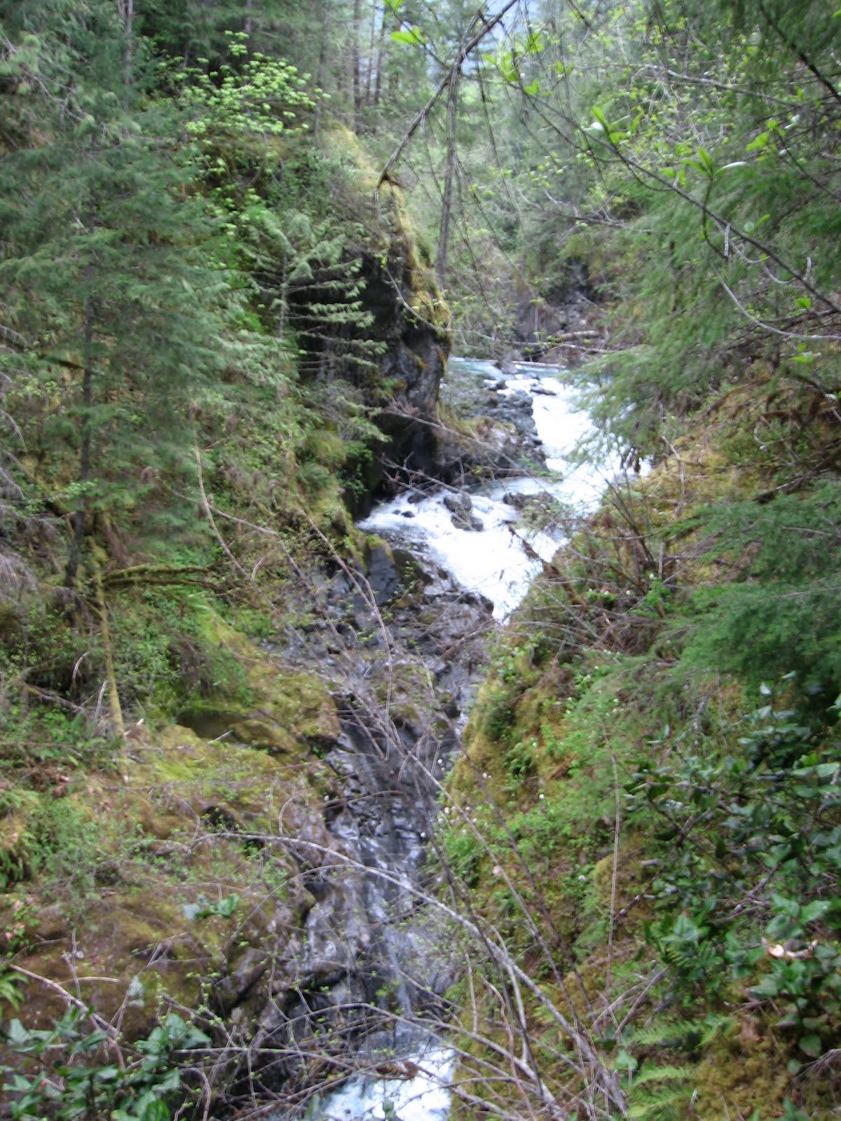
We came down on top of a canyon wall that was 60 to 80 feet above the river. It was too sketchy to look over the edge but I could see up-stream well and a boulder garden that was fairly long and continuous, about 100 yards long before it went out of sight. What I was able to see looked quality and it motivated me to find more spots to access the river.

View through the trees from high on canyon rim
We hiked back to the trail and Taryn noticed a second trail just slightly further up the trail from where we exited the woods. This second one was littered with remnants from the logging that had gone on in these parts years ago. But this trail was a jack-pot. We were able to get right down to river level above where I had lost sight of the river from the bluff. By now rain had come and we weren't ready for it, so I was trying to be efficient with my time. I scrambled down a loose bank and was able to climb onto some boulders on river left and look up and downstream.

River level looking downstream. The second ledge had a serious hole.

river level looking upstream
The water level was a little low, but a lot more water would make this gorge a class V stretch. Everything I saw looked runnable at this level and class IV, with eddies and ledges, anything that couldn't be scouted from shore looked like would be boat scoutable. I tried to get upstream further but was blocked by another bluff, and the rain was on its way down so we headed back to the car. There was one bluff I climbed up on on the way out and was able to see what I believed to be the entrance to the gorge. According to beta on the American Whitewater page there is a boulder that blocks this entrance and make it an unrunnable drop. There was defiantly a significant loss of elevation in this spot but I was not able to visually confirm the boulder blocking the river. A bluff stuck out into my line of sight so all I could see was the shore and what I think is the lead-in to the canyon.
What I believe is the entrance to the canyon and where the boulder obstruction is
I'd like to go back in and scout the lead-in and the spot downstream of where I initially was able to see the gorge. The canyon is short but it looks quality. If I paddled it I'd run it at lower flows to determine what the drops were like. the guage said on this day that the river was at 1.65 ft. and recommended flows for the rapids above and below the gorge is 2.00 ft. That much water in the gorge would be big so it's hard to say what it would look like.
There is also a trail that I believe is the "portage trail", it is the most obvious of all the trails and has a sign that says "no hunting no trespassing" and a log and sticks placed there to block the path. This is likely the best way to see the boulder obstruction.
We ran out of time and weren't able to go down this last trail but instead went back to the car and ate our sandwiches. On the drive home we stopped at a park and Taryns car battery died and I asked a nice trio of three who were barbecuing in the sun and increasing wind. They were nice and helped us no problems. Were didn't want to ask the young mom in the car next to us who was yelling at her kids, and talking about her "baby daddy" (her words not mine) loudly with her friend.
The mission got me excited about going back and taking a look at what is down in all the places I wasn't able to see. But that will have to wait until next time.

Map
No comments:
Post a Comment